 Catalogue PIGMA
Remote sensing
Type of resources
Available actions
Topics
Keywords
Contact for the resource
Provided by
Years
Formats
Representation types
Update frequencies
status
Scale
Resolution
-
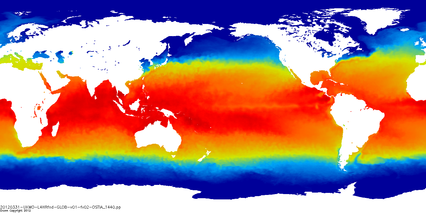
Advanced Along-Track Scanning Radiometer multimission data have been reprocessed to provide update retrievals of Sea Surface Temperature (SST) to produce the AATSR Reprocessing for Climate (ARC) dataset.
-
-
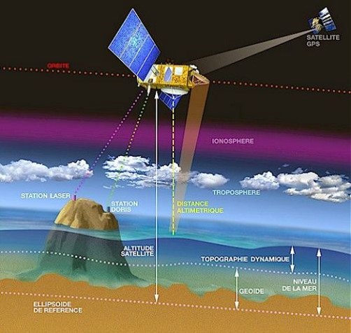
Along-track altimetric GDR (Geophysical Data Record) products , geophysical and environmental corrections to apply. Available missions are: GFO, Topex/Poseidon, Envisat, Cryosat-2, Jason-1, Jason-2, Jason-3, Saral/AltiKa. Missions with several successive orbital types are treated in their entirety. Compared to the original version of the GDR files distributed by the CNES, ESA, NASA and ISRO agencies, the CTOH proposes new corrections and parameters in these files, which are to be applied to the initial altimetry measurement, according to user needs. Children metadata files are available for each mission.
-
Ocean-surface optical parameters: reflectances
-
Ssalto/Duacs multimission gridded sea surface heights products. From January 1993 to the last extension of the Delayed-time products, the long delayed-time dataset allows to compute statistical means of Maps of Sea Level Anomalies (MSLA) over different periods of time. Computed with respect to a twenty-year mean profile [1993-2012], and including the seasonal variability (no annual cycle is removed).
-
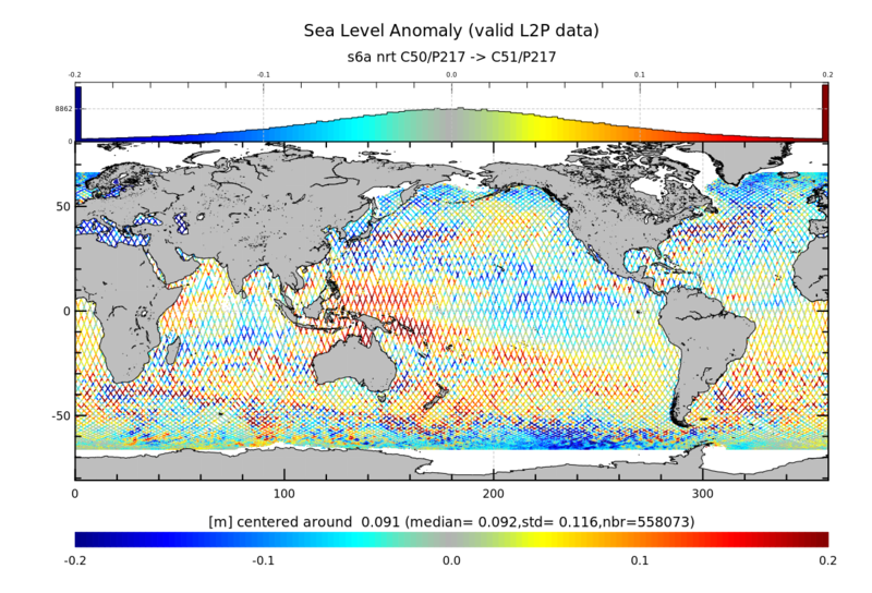
Monomission altimeter product, available for several missions in Near-Real Time (NRT), Short Critical Time (SCT) and Non Time Critical Time (NTC)
-
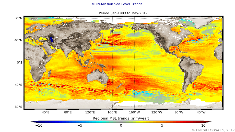
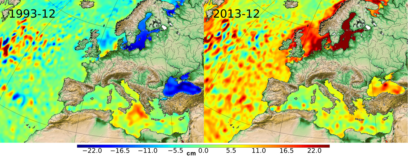
The global mean level of the oceans is one of the most important indicators of climate change. It incorporates the reactions from several different components of the climate system. Precise monitoring of changes in the mean level of the oceans, particularly through the use of altimetry satellites, is vitally important, for understanding not just the climate but also the socioeconomic consequences of any rise in sea level.
-
Monomission altimeter product: OSTM/Jason-2. These products were produced by CLS in the framework of the Pistach project, funded by Cnes.
-
Multimission altimetry-derived gridded from Ssalto/Duacs products backward-in-time Finite Size Lyapunov Exponents and Orientations of associated eigenvectors
-
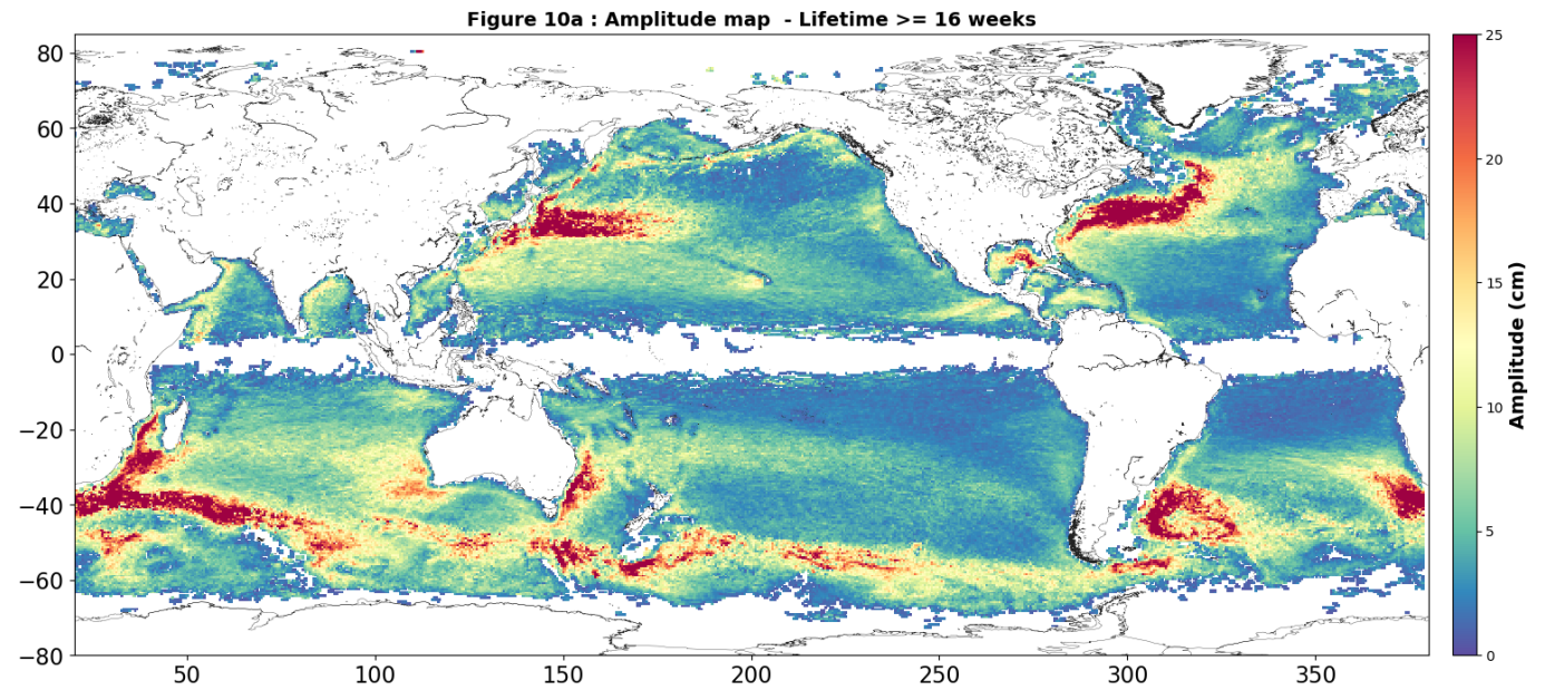
Eddies detected in Delayed-Time (DT) for the entire period [1993 - present]. Variables provided include day-by-day, and for one rotation type (Cyclonic/Anticyclonic) : - Center position (Longitude and latitude of the center of the best fit circle with the contour of maximum circum-average geostrophic speed); - Amplitude (|SSH(local_extremum) – SSH(outermost_contour)|); - Speed radius (Radius of the best fit circle with the contour of maximum circum-average geostrophic speed); - Speed average (Average geostrophic speed of the contour defining the speed radius); - Speed profile (Profile speed average values from effective contour inwards to smallest inner contour); - Effective contour (Largest contour of the detected eddy); - Speed contour (Contour of maximum circum-average geostrophic speed for the detected eddy).